
The lime kilns at David Mitchell's Cave Hill Estate required huge quantities of firewood. 100 acres of timber were cleared each year to fire them, with the timber hauled by a steam engine on a narrow-gauge tramway. Mitchell's land included the north-west corner of Mt Evelyn, and it is likely that the early tram tracks extended into this area.
Mitchell bought two locomotives from the Bendigo Tramways in 1903. By 1907 the timber on his estate had been exhausted, and he applied for a permit to build a tramway along Olinda Creek to collect wood cleared by settlers. The new tracks were standard-gauge (4'8½"). They extended along the west side of Olinda Creek, and up York Road.
The line then branched into three. One branch continued straight ahead into what is now the Mt Evelyn Reserve. This route is now Tramway Road. The middle line extended up the west side of Olinda Creek to opposite Hunter Road. The right branch ran to Wishing Well Creek and a short distance beside it. This branch appears on Google Maps as 'Tramway Track'. The tramway relics, including a trestle bridge over Wishing Well Creek, have been much disturbed by construction of the pipelines from Silvan.
Ralph Alger (whose article is our main information source) was fairly sure there had been an earlier branch of the tramway in the David Road area. He thought it ran close to the David Road/Fuller Road alignment, and was largely obliterated when the roads were made. Douglas Knox, who lived in David Road as a boy, thought the tramway would have gone via a cutting that ran up the length of the creek gully (a.k.a. the Fuller Road Drain). Isolated sections of formation remain on private land, but not enough to reconstruct the route with certainty.
Sections of tramway are also preserved off the Lillydale Lake circuit, and in the TAFE grounds.
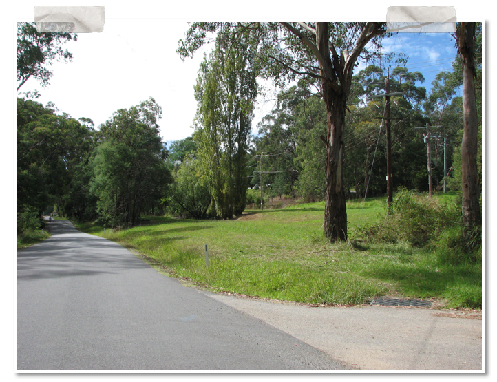
The three branches of the Cave Hill Tramway, from near the entrance to Mt Evelyn Reserve. Photo Kevin Phillips.
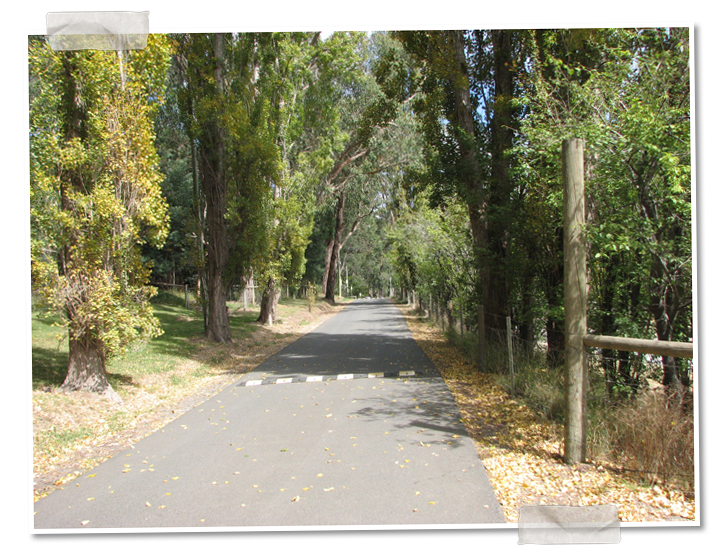
Tramway Road through Mt Evelyn Reserve, formerly the tramway alignment. Photo Kevin Phillips.
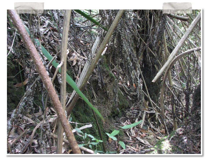
This loading platform, much overgrown, can still be found beside Wishing Well Creek. Photo Kevin Phillips.
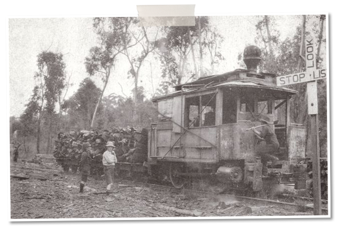
Top photo: 'Mitchell's Tram' at Mistletoe Bend (site of Mt Evelyn Reserve), 3 March 1927. The STOP LOOK LISTEN sign places it at the level crossing of the road and tramway. Photo Reg Falkingham, courtesy John Keane.
Sources
Ralph Alger, 'Reminiscences of the Cave Hill Tramway', Light Railways No.111, January 1991.
Arthur Winzenried 1985, 'The Cave Hill Tram, Lilydale', APW Research Report 10, APW Productions.
See also Things Past #40, #98, #99, #118.